View2Plan: Section & Profile Projection
v1.1.0 FreePick points in a Civil 3D Section View or Profile View and get them at their true position in plan, as COGO points or AutoCAD points with a 3D polyline. No manual station and offset calculation.
Works with
- Civil 3D
- Checksum published
- On the Autodesk App Store
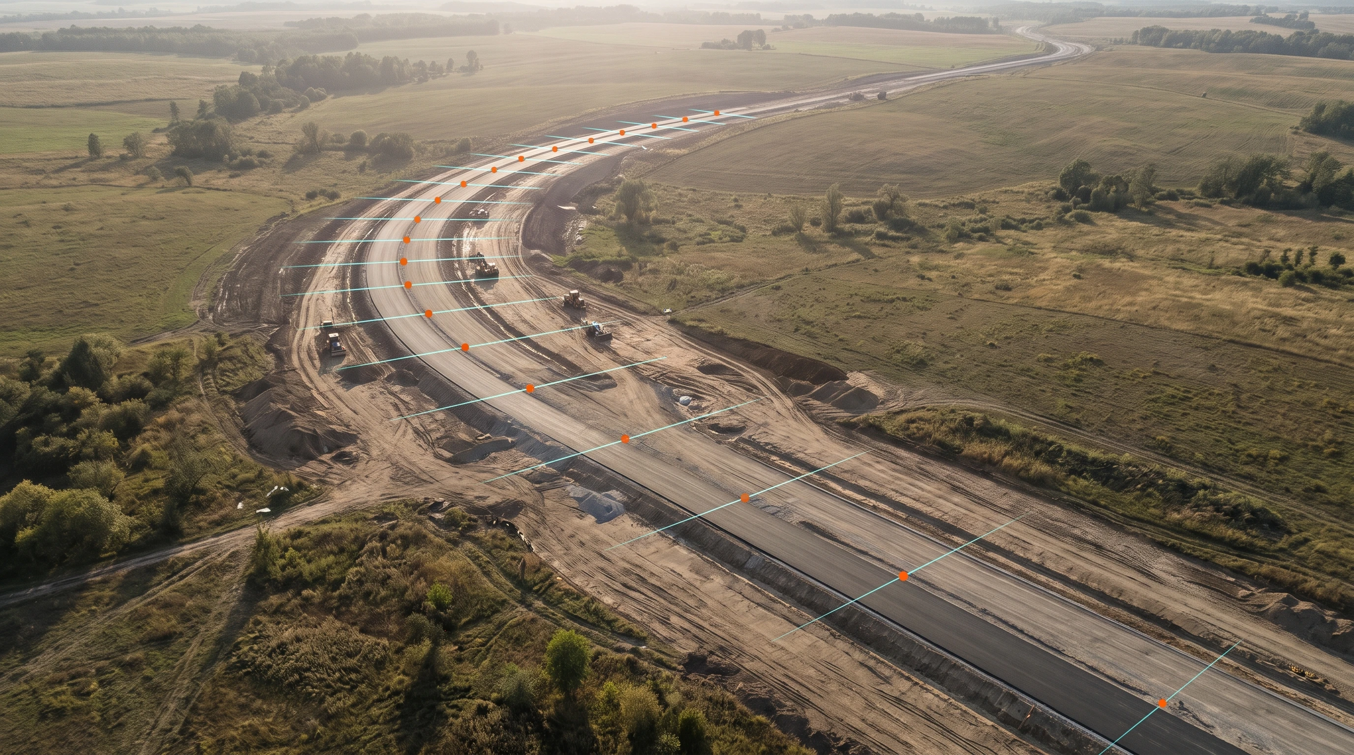
A section or profile view shows you exactly where a kerb edge, a pipe, a retaining wall or a grading limit should be, but only as station, offset and elevation. Getting that point into plan normally means reading the values off the view, working out the position along the alignment and typing coordinates, one point at a time. View2Plan removes that step: you click in the view and the point appears in plan at its true coordinates, with the elevation you picked.
Section View to plan
Run GR_S2PL (ribbon: Section → Plan), select a section view and click points inside its grid. Each point is placed on the sample line of that view, at the picked offset and elevation. Skewed and multi-segment sample lines are followed correctly: the offset is measured along the sample line from the point where it crosses the alignment.
Profile View to plan
Run GR_P2PL (ribbon: Profile → Plan), select a profile view and click points. Each point is placed on the alignment, at the picked station and with the picked elevation. A click outside the station range of the view is ignored with a warning, and you keep picking.
Live preview, nothing written until you finish
While you pick, View2Plan draws only temporary graphics: markers on the view and a live preview of the result in plan. Type U to remove the last point. When you press Enter, the points and the 3D polyline are created in one step, so a single UNDO removes the whole run. If you like, the markers stay on the view after the command, until you regenerate or save the drawing.
Four output modes
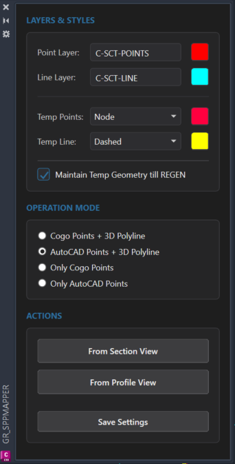
Choose what is created: COGO points with a 3D polyline, AutoCAD points with a 3D polyline, COGO points only, or AutoCAD points only. COGO points get the raw description V2P, so your description keys and point groups can pick them up.
Your layers and colours, saved between sessions
The settings palette (SPPMAPPER) holds the point layer, the line layer, their colours and the look of the temporary graphics. Settings are saved for your user and restored the next time. A layer that does not exist is created; a layer that already exists is never changed.
On the Add-ins tab, in any UCS
The four buttons sit on the Plan Projection panel of the Add-ins tab; hover a button for a description and press F1 for help. Picking works in any UCS. Results are always created in model space, in world coordinates and in the units of your drawing.

Requirements
- Civil 3D 2021–2027 (64-bit)
- Windows 10 or 11
- Drawing an alignment and at least one Section View or Profile View
- Licence free, no activation and no account
- Not supported plain AutoCAD without Civil 3D
View2Plan is a free add-in for Autodesk Civil 3D. You click points inside a Section View or a Profile View, and View2Plan creates them at their true position in plan, with the elevation you picked. Use it to bring structures, utilities, kerb lines or grading limits from your sections and profiles into plan without calculating station, offset and coordinates by hand.
Commands
- View2Plan (
SPPMAPPER): opens the settings palette: point layer, line layer, colours, temporary graphics and output mode, with buttons to start picking. - Section → Plan (
GR_S2PL): pick points in a Section View. Each point is placed on the sample line of that view, at the picked offset and elevation. - Profile → Plan (
GR_P2PL): pick points in a Profile View. Each point is placed on the alignment, at the picked station and elevation.
How to use
- Open the palette (
SPPMAPPER) and set the layers, colours and output mode. - Click From Section View or From Profile View and select the view.
- Click points inside the view grid. Markers appear on the view and a live preview of the result appears in plan. Type
Uto remove the last point. - Press Enter or right-click. The points and the 3D polyline are created in one step, so a single
UNDOremoves the whole run.
What you get
COGO points or AutoCAD points, with or without a 3D polyline through them, on the layers you chose, in model space and in world coordinates.
No licence key, no trial period and no account needed.
SHA-256
652b40e08fc424b260f7e395df6bcc25953cc962f6bf3031d765b7d042fcbd2c
Frequently asked questions
Is View2Plan free?
Yes. View2Plan is free: no licence key, no trial period and no account.
Which Civil 3D versions does it work with?
Civil 3D 2021 to 2027. It does not load in plain AutoCAD, because it needs Civil 3D section views, profile views and alignments.
Where do I find it after installing?
Restart Civil 3D and open the Add-ins tab of the ribbon. The Plan Projection panel has four buttons: View2Plan, Section → Plan, Profile → Plan and Help & About. You can also type the commands: SPPMAPPER, GR_S2PL, GR_P2PL.
Can I undo what it created?
Yes. While picking, U removes the last point. After you finish, a single UNDO removes the whole run, all points and the polyline.
Does it change my layers?
No. If the layer you named does not exist, View2Plan creates it with the colour you chose. A layer that already exists is never changed.
Does it work with skewed sample lines?
Yes. From version 1.1.0 the points follow the sample line of the section view, also when it is skewed to the alignment or has several segments.
I get "Cannot locate resource 'themes/colors.xaml'". What should I do?
This error appeared in version 1.0.0 when another add-in was loaded before View2Plan. It is fixed in version 1.1.0. Install the current version.
How do I update from version 1.0.0?
Close Civil 3D and install the new version. The installer removes the old version itself and installs the new one. Your saved settings are kept. New COGO points get the raw description V2P instead of GP_NODE, so update any description keys or point groups built on the old text.